
| Port Kennedy Train Station during the Bicentennial (photograph)  |
Archeological Dig at Catfish Dam (photograph)  |
Boy Jumping into the Schuylkill River near the Bridgeport-Norristown Viaduct. (photograph)  |
P&W Liberty Liner Crossing the Bridgeport-Norristown Viaduct over the Schuylkill (photograph)  |
P&W Bullet Cars Crossing the Bridgeport-Norristown Viaduct over the Schuylkill (photograph)  |
| Blacksnake Quarry, Eastburn's Hill (photograph)  |
Blacksnake Quarry, Eastburn's Hill (photograph)  |
Valley Forge Train Station (postcard)  |
Washington's Headquarters (postcard)  |
Textile Workers Houses, Valley Forge (postcard)  |
| Port Kennedy Bridge (Singing Bridge) (postcard)  from Betzwood to Port Kennedy, circa 1910.") |
Loughins Hotel, Port Kennedy (postcard)  |
Host Inn, Harrisburg (postcard)  |
Host Inn, Harrisburg (postcard)  |
Gulph Mills - Headquarters (photograph)  |
| Fort Washington, Valley Forge (postcard)  |
Fort Huntingdon, Valley Forge (postcard)  |
First Presbyterian Church of Port Kennedy (postcard)  |
Cinder Ave, Port Kennedy (postcard)  |
Carriage House, King of Prussia (photograph)  |
| Canal Boat in Bridgeport (postcard)  |
Striking Textile Workers, Bridgport (photograph)  |
1st Gulf Mills (Gulph Mills) Boy Scout Troop (postcard)  Boy Scout Troop, c. 1920.") |
Pennsylvania Columns, Valley Forge (postcard)  |
Valley Creek Dam, Valley Forge (postcard)  |
| Lafayette's Headquarters, Valley Forge (postcard)  |
Anthony Wayne's Headquarters, Valley Forge (postcard)  |
Memorial Arch, Valley Forge (postcard)  |
The Bake House, Valley Forge (postcard)  |
Washington's Headquarters, Bicentennial (postcard)  |
| Washington Inn, Valley Forge (postcard)  |
Memorial Arch, Valley Forge (postcard)  |
Statue of George Washington, Valley Forge (postcard)  |
Washington Memorial Chapel and Bell Tower, Valley Forge (postcard)  |
PA Turnpike Postcard (postcard)  |
| Turnpike Howard Johnsons and Valley Forge Attractions (postcard)  |
Valley Forge Presbyterian Church (postcard)  |
P&W Bullet Train (postcard)  |
Danny (postcard)  |
Port Kennedy Train Station (Valley Forge Park) (photograph)  |
| Knox Covered Bridge, Valley Forge (postcard) ") |
King of Prussia Inn (rear of building) (postcard)  |
Old Octagon Schoolhouse (postcard)  |
Old Barracks, Valley Forge (postcard)  |
Headquarters Provost Guard, Valley Forge (postcard)  c. 1910") |
| Washington Spring, Valley Forge (postcard) ") |
Holstein Street School (postcard)  |
Mill Near Port Kennedy (postcard)  |
Soldier's Monument, Valley Forge (postcard)  |
Washington's Headquarters at Valley Forge; Winter (postcard)  |
| PA Turnpike Valley Forge Terminus (postcard)  |
General Knox's Quarters, Valley Forge (postcard)  |
Washington Inn (postcard)  |
Gulph Mills (Gulf Mills) Stone Marker (postcard)  Stone Marker, c. 1905") |
American Baptist Convention (Holy Donut/Doughnut) (postcard) , mid-1960s") |
| Philadelphia & Reading RR Ticket (artifact)  |
Valley Forge North and South Carolina Militia Postcard (postcard)  |
Reading Railroad Station at Valley Forge (postcard)  |
Valley Forge Nurseries (postcard)  |
Covered Bridge at Valley Forge with Boathouse visible (postcard)  |
| Washington's Headquarters at Valley Forge (postcard)  |
Schoolhouse at Valley Forge (postcard)  |
Fort Washington Breastworks at Valley Forge (postcard)  |
Williams Girls in front of the Swedeland Hotel (photograph)  |
King of Prussia Inn, 1980s (photograph)  |
| King of Prussia Inn 1980s (photograph)  |
Continental Arms Apartments (postcard)  |
Red Arrow Bullet Train in Bridgeport 1971 (postcard)  |
Philadelphia & Reading RR Ticket 1893 (artifact)  |
Bridgeport Tax Receipt 1855 (artifact)  |
| Historical Map of Upper Merion Township (map)  |
King of Prussia Historical Society Follow-up Report on Historic Structures to the Upper Merion Planning Commission. (booklet)  |
King of Prussia Historical Society Report on Historic Structures to the Upper Merion Planning Commission, 1959-60 (booklet)  |
The Upper Merion Story: An Overview of Historic Structures in Upper Merion (booklet)  |
Wintering 1777-78: The History of Peter Muhlenberg's Headquarters (article)  |
| PHMC Documentation on the Moore-Irwin house (Muhlenberg's Quarters) (booklet)  |
Letter from Richard Heckscher & Sons, Swedeland (letter)  |
Christ Church (Old Swedes) Postcard (postcard)  |
Christ Church (Old Swedes) Interior Postcard (postcard)  |
The Justice Bell in Valley Forge (photograph)  |
| Gulph Mills Marker (detail) (photograph)  |
Gulph Mills Marker (photograph)  |
Upper Merion Area School District Elementary Boundaries 2019-20 and After (map)  |
Upper Merion Area School District Elementary Boundaries Before 2019-20 (map)  |
Farm House on the Corner of Caley Rd and Beidler Rd (photograph)  |
| 1912 Mueller Atlas: Swedeland Area (map)  |
1912 Mueller Atlas: Valley Forge Area (map)  |
1912 Mueller Atlas: Abrams (Abrahams) Area (map)  |
Valley Creek (postcard)  |
Swedes Ford (Swedesford) Crossing (artwork) , 1828.") |
| Christ Church (Old Swedes) (photograph)  before 1880, showing the old bell tower.") |
Muhlenberg Headquarters (artwork)  illustration, 1956.") |
King of Prussia Inn, 1905 (photograph)  |
Knox Covered Bridge, Valley Forge (photograph)  |
Hanging Rock Postcard (postcard)  |
| Gulf (Gulph) Mills Grist Mill (postcard)  |
Abrams Chapel (photograph)  |
Bridgeport and Norristown Aerial Photo - from the 1966 Montgomery County Road Map (photograph)  |
1966 Montgomery County Road Map Detail: Upper Merion (map)  |
1953 Montgomery County Road Map Detail: Upper Merion (map)  |
| 1988 Upper Merion Township Map (map)  |
Upper Merion Voting Precincts Map c. 1960 (map)  |
1913 Mueller Atlas: Gulph Mills Area (map)  |
1913 Mueller Atlas: King of Prussia (map)  |
1977 Flood Insurance Map of Part of Upper Merion (map)  |
| 1965 Upper Merion Map (Chamber of Commerce) (map)  |
Upper Merion Zoning Map 1980-81 (map)  |
1960 Upper Merion Township Map (map)  |
Washington Oak (Drinker Oak) (photograph) , 1960s.") |
Washington's Headquarters at Valley Forge (postcard)  |
| Valley Forge State Park Sign (postcard)  |
Old Gulph Road, Valley Forge (postcard)  |
Mount Joy Observation Tower, Valley Forge (postcard)  |
Mount Joy Observation Tower, Valley Forge (postcard)  |
Greetings from Valley Forge (postcard)  |
| Construction of the National Memorial Arch, Valley Forge (postcard)  |
Valley Forge Train Station, Winter (postcard)  |
Valley Forge Train Station (postcard)  |
Upper Merion Swim Club (postcard)  |
PA Turnpike Valley Forge Toll Plaza (postcard)  |
| PA Turnpike America's Superhighway (postcard)  |
PA Turnpike and Schuylkill Expressway Interchange (postcard)  |
Talley Ho Motel (postcard)  |
Stouffer's Valley Forge Inn (postcard)  |
Sheraton Valley Forge Hotel (postcard)  |
| Port Kennedy Train Station and Hotel (postcard)  |
Loughin's Hotel, Port Kennedy (postcard)  |
Peacock Gardens (postcard)  |
Peacock Gardens (postcard)  |
Martin's Dam Swim Club (postcard)  |
| Maple Croft Farm Flyer (brochure/pamphlet)  |
Mansion House, Valley Forge (postcard)  |
Main Street, Port Kennedy (postcard)  |
Sheraton Let Yourself Go Weekend (brochure/pamphlet)  |
Lafayette Swim Club (postcard)  |
| General Lafayette Motel (postcard)  |
General Lafayette Headquarters (postcard)  |
King of Prussia Antique Store and Post Office (postcard)  |
King of Prussia Plaza (postcard)  |
King of Prussia Plaza (postcard)  |
| King of Prussia Plaza (postcard)  |
King of Prussia Plaza (postcard)  |
King of Prussia Plaza (postcard)  |
King of Prussia Motor Inn (postcard)  |
King of Prussia Inn (photograph)  |
| King of Prussia Inn (photograph)  |
King of Prussia Inn (postcard)  |
Knox Covered Bridge Damaged in 1967 (postcard)  |
Knox Covered Bridge (photograph)  |
King of Prussia Inn (postcard)  |
| Kenhurst, Port Kennedy (Kennedy Supplee Mansion) (postcard)  |
Kenhurst, Port Kennedy (Kennedy Supplee Mansion) (postcard)  |
Entrance to Kenhurst (Kennedy-Supplee Mansion) (postcard)  |
Howard Johnsons (postcard)  |
Upper Merion Homecoming, 1971 (photograph)  |
| Holiday Inn (postcard)  |
Harvest House Restaurant (postcard)  |
Stone Marker near Gulph Mills (postcard)  |
Hanging Rock, Gulph Road (postcard)  |
Hanging Rock, Gulph Road (postcard)  |
| George Washington Motor Lodge (postcard)  |
Washington Inn Ironwork. (postcard)  |
First Presbyterian Church of Port Kennedy (postcard)  |
Family at Valley Forge (photograph)  |
Christ Church (Old Swedes) Postcard (postcard)  Postcard, c. 1900") |
| Catfish Dam on the Schuylkill (postcard)  |
4th Street in Bridgeport (photograph)  |
Calhoun Street Bridge Morrisville - Trenton (photograph)  |
DeKalb Street Wooden Covered Bridge (photograph)  |
Bird in Hand (Gulph Mills) Postcard (postcard)  c. 1920") |
| Abrams Chapel 1934 (photograph)  |
US 422 Bridge Construction 2019 (photograph)  |
US 422 Bridge Construction 2019 (photograph)  |
PA 363 Bridge Construction 1965 (photograph)  |
Municipal Map of Bridgeport 1935 (map)  |
| Upper Merion Zoning Map 1957-58 (map)  |
Upper Merion Junior Prom Letter 1966 (artifact)  |
Schuylkill River Crossing Bridgeport and Norristown (postcard)  |
Wolfsohn Library Card (artifact)  |
King of Prussia Indians Football Patches (artifact)  |
| Dam on Valley Creek (postcard)  |
DeKalb Street Wooden Covered Bridge (postcard)  |
DeKalb Street Wooden Covered Bridge (postcard)  |
King of Prussia Food Shop Advertisement (ad)  |
Art Cummings Gas Station (photograph)  |
| William Kelley House (photograph)  |
1950s Vaccination Records (artifact)  |
Various Sports Patches (artifact)  |
Various Sports Patches 1962 and 1986 (artifact)  |
Mother of Divine Providence School Book Cover (artifact)  |
| Selective Service Induction Letter 1970 (artifact)  |
King of Prussia Indians Football Patches (artifact)  |
Bux-Mont Football Schedule 1963 (brochure/pamphlet)  |
Bux-Mont Football Schedule 1961 (brochure/pamphlet)  |
Washington Inn (postcard)  |
| Washington Headquarters at Valley Forge (postcard)  |
Schuylkill River at Valley Forge Train Station (postcard)  |
Covered Bridge at Valley Forge (postcard)  |
Gulf (Gulph) Mills Marker (postcard)  |
Brass Tool Tag - Bethlehem Steel Bridgeport Quarry (artifact)  |
| Aerial Oblique North Central Upper Merion (aerial photo)  |
Aerial Oblique North Central Upper Merion, 1956 (aerial photo)  |
Aerial Oblique Northeastern Upper Merion (aerial photo)  |
Candlebrook Development Brochure (brochure/pamphlet)  |
Upper Merion Business Directory 1915 (booklet)  |
| Port Kennedy Train Station (photograph)  |
King of Prussia Marble Fireplace in Selma Mansion 2 (photograph)  |
King of Prussia Marble Fireplace in Selma Mansion 1 (photograph)  |
1893 Geology of Montgomery County - J.L. Smith Atlas (map)  |
1770 Map of the Province of Pennsylvania (Detail) (map)  |
| Mullen Parcel (photograph) ") |
Mullen Parcel (photograph) ") |
Mullen Parcel (photograph) ") |
Mullen Parcel (photograph) ") |
Mullen Parcel (photograph) ") |
| Mullen Parcel (photograph) ") |
Valley Forge Tavern Ad (1962 Valley Forge Music Fair Program) (ad)  |
Miss Jeanne (ad)  |
Peacock Gardens Ad, 1962 (Valley Forge Music Fair Program) (ad)  |
Valley Forge Music Fair Program: Brigadoon, 1962. (booklet)  |
| Michell Growers Catalog (booklet)  |
Dedication of the New Post Office, 1962 (article)  |
Flood at Walker Field 1968 (photograph) .") |
Valley Forge Orchards (photograph) ") |
King of Prussia Courier - Plaza Dinosaur Exhibit Ad (ad) ") |
| Dinosaur Exhibit at the King of Prussia Plaza 1967 (photograph) ") |
Dinosaur Exhibit at the King of Prussia Plaza 1967 (photograph) ") |
King of Prussia Plaza 1970 (photograph) ") |
Upper Merion Area Relief Map (map)  |
Anna Morris Holstein Grave (photograph)  |
| Anna & William Holstein House, 2018 (photograph)  |
Southeast PA Relief Map Showing the Chester Valley (Great Valley) (map)  - a long limestone valley from the Schuylkill to Lancaster County.") |
Upper Merion Area Relief Map (with roads) (map)  |
1893 Smith Atlas: West Conshohocken, Gulph Mills and Mechanicsville Map (map)  |
1893 Smith Atlas: Bridgeport and Swedesburg Map (map)  |
| 1895 USGS Topo Map - Upper Merion (map)  |
Aerial Oblique Image - Belmont Farm (aerial photo)  |
Aerial Oblique Image - Diamond State Fiber Company, Bridgeport (aerial photo)  |
Aerial Oblique Image - Diamond State Fiber Company, Bridgeport (aerial photo)  |
Aerial Oblique Image - Valley Forge Train Station (aerial photo)  |
| Aerial Oblique Image - Intersection of Gulph and Henderson (aerial photo)  |
Aerial Oblique Image - Hughes Park (aerial photo)  |
Aerial Oblique Image - Norristown-Bridgeport Schuylkill River Bridges (aerial photo)  to Bridgeport (right), 1924. Courtesy of the Library Company of Philadelphia.") |
Aerial Oblique Image - Diamond State Fiber Company, Bridgeport (aerial photo)  |
Upper Merion Township: Freedom (brochure/pamphlet)  |
| Caley Elementary Tile Mural (artwork)  |
Anna and William Holstein with members of the Sanitary Commission (photograph) ") |
Anna Morris Holstein (photograph) ") |
Colonial Village Swim Club (postcard)  |
Bus Making Its Way Around Hanging Rock, 1954 (photograph)  |
| Hanging Rock Photo 1954 (photograph)  |
Edward Conard et al., Photograph with Funeral Notice (photograph)  |
Port Kennedy Train Station (postcard)  |
Panoramic View of King of Prussia, November 2017 (photograph)  |
Panoramic View of King of Prussia, April 2017 (photograph)  |
| Trout Run Study (map) .") |
1956 King Manor Land Use Map (map)  |
1956 Swedeland Land Use Map (map)  |
1956 Gulph Mills Land Use Map (map)  |
1985 Upper Merion Zoning(?) Map (map)  |
| 1951 Upper Merion Zoning Map (map)  |
Upper Merion Official Street Map 1983 (map)  |
Panoramic View of King of Prussia, February 2017 (photograph)  |
Panoramic View of King of Prussia, December 2016 (photograph)  |
Roads and Proposed Road Improvements, Upper Merion 1958 (map)  |
| Regional Business District Plan, 1955 (map)  |
Detail: Proposed Route 202 Relocation, 1958 (map)  |
Croton Woods Land Use Map 1956 (2) (map)  |
Croton Woods Land Use Map 1956 (map)  |
Candlebrook Land Use Map 1956 (map)  |
| Upper Merion Land Use Map 1952 (map)  |
1871 Hopkins Atlas - Upper Merion Map Detail - Abrahams (Abrams) (map)  |
The Farm & Residence of Thomas Abraham, 1877 Illustration (artwork)  |
House of William H. and Anna Morris Holstein, 1877 Illustration (artwork)  |
Illustrations of Houses from the 1877 Montgomery County Atlas (artwork)  |
| 1877 Montgomery County Map - Detail: Upper Merion (map)  |
1877 Montgomery County Map with Travel Distances (map)  |
1849 Montgomery County Map Detail: Upper Merion (map)  |
1849 Montgomery County Map (map)  |
1893 Smith Atlas: Upper Merion Map (map)  |
| PA Turnpike King of Prussia Interchange Postcard 1955 (postcard)  |
King of Prussia Inn 1938 Postcard (postcard)  |
Christ Church (Old Swedes) Postcard (postcard)  - undated.") |
Aerial Flyover of Upper Merion - 2016 (video) 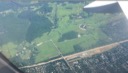 |
Benjamin H. Smith Atlas of Delaware County and The Welsh Tract - Upper Merion (map)  |
| 1871 Hopkins Atlas - Upper Merion Map Detail - West Conshohocken - Gulf (Gulph) Mills - Mechanicsville (map)  Mills and Mechanicsville 1871 detail from the Hopkins Montgomery County Atlas.") |
1871 Hopkins Atlas - Upper Merion Map Detail - Valley Forge (map)  |
1871 Hopkins Atlas - Upper Merion Map Detail - Henderson Station - Gulf (Gulph) Mills (map)  Mills 1871 detail from the Hopkins Montgomery County Atlas.") |
1871 Hopkins Atlas - Upper Merion Map Detail - Swedeland - Swedesburg (map)  |
1871 Hopkins Atlas - Upper Merion Map Detail - Shainline - Henderson Station (map)  |
| 1871 Hopkins Atlas - Upper Merion Map Detail - Port Kennedy (map)  |
1871 Hopkins Atlas - Upper Merion Map Detail - Swedeland - Matsunk (map)  |
1871 Hopkins Atlas - Upper Merion Map Detail - King of Prussia (map)  |
1871 Hopkins Atlas - Upper Merion Map (map)  |
A. H. March Meat Packing Plant - Bridgeport (photograph) ") |
| A. H. March Meat Packing Plant on the Schuylkill Canal - Bridgeport (photograph) ") |
A. H. March Meat Packing Plant - Bridgeport (photograph) ") |
River Patrolman at the A. H. March Meat Packing Plant - Bridgeport (photograph) ") |
A. H. March Meat Packing Plant - Bridgeport (photograph) ") |
1928 Aerial Image - Valley Forge and Port Kennedy (aerial photo)  |
| 1928 Aerial Image - Northern Upper Merion and Bridgeport (aerial photo)  |
1928 Aerial Image - Northern Main Line - Southern Upper Merion (aerial photo)  |
An Historical Map of Upper Merion Township, 1956 (map)  |
2000 Aerial Image - Swedesburg - Eastern Bridgeport (aerial photo) ") |
2000 Aerial Image - Swedeland Area (aerial photo) ") |
| 2000 Aerial Image - Gulph Mills - West Conshohocken (aerial photo) ") |
2000 Aerial Image - Blue Route - Schuylkill Interchange (aerial photo) ") |
2000 Aerial Image - Belmont - Western Bridgeport Area (aerial photo) ") |
2000 Aerial Image - Henderson Road Area (aerial photo) ") |
2000 Aerial Image - Merion Hills Area (aerial photo) ") |
| 2000 Aerial Image - Abrams (Abrahams) Area (aerial photo) ") |
2000 Aerial Image - Caley Road Area (aerial photo) ") |
2000 Aerial Image - King of Prussia Downtown (aerial photo) ") |
2000 Aerial Image - Colonial Village Area (aerial photo) ") |
1990 Aerial Image - Swedesburg - Swedeland (aerial photo) ") |
| 1990 Aerial Image - West Conshohocken - Conshohocken (aerial photo) ") |
1990 Aerial Image - Bridgeport - Norristown (aerial photo) ") |
1990 Aerial Image - Hughes Park - Bridgeport (aerial photo) ") |
1990 Aerial Image - Gulph Mills (aerial photo) ") |
1990 Aerial Image - Abrams (Abrahams) Area (aerial photo) ") |
| 1990 Aerial Image - King of Prussia (aerial photo) ") |
1990 Aerial Image - Upper Gulph Area (aerial photo) ") |
1980 Aerial Image - Swedesburg - Swedeland (aerial photo) ") |
1980 Aerial Image - West Conshohocken - Conshohocken (aerial photo) ") |
1980 Aerial Image - Bridgeport - Norristown (aerial photo) ") |
| 1980 Aerial Image - Hughes Park - Bridgeport (aerial photo) ") |
1980 Aerial Image - Gulph Mills (aerial photo) ") |
1980 Aerial Image - Abrams (Abrahams) Area (aerial photo) ") |
1980 Aerial Image - King of Prussia (aerial photo) ") |
1980 Aerial Image - Upper Gulph Area (aerial photo) ") |
| 1970 Aerial Image - Swedesburg - Swedeland (aerial photo) ") |
1970 Aerial Image - West Conshohocken - Conshohocken (aerial photo) ") |
1970 Aerial Image - Bridgeport - Norristown (aerial photo) ") |
1970 Aerial Image - Hughes Park - Bridgeport (aerial photo) ") |
1970 Aerial Image - Gulph Mills (aerial photo) ") |
| 1970 Aerial Image - Abrams (Abrahams) Area (aerial photo) ") |
1970 Aerial Image - King of Prussia (aerial photo) ") |
1970 Aerial Image - Upper Gulph Area (aerial photo) ") |
1959 Aerial Image - West Conshohocken Area (aerial photo) ") |
1959 Aerial Image - Gulph Mills (aerial photo) ") |
| 1959 Aerial Image - Upper Gulph Area (aerial photo) ") |
1959 Aerial Image - King of Prussia (aerial photo) ") |
1959 Aerial Image - Abrams (Abrahams) Area (aerial photo) ") |
Loughin House (photograph) ") |
Washington Memorial Chapel (photograph) ") |
| Loughin Family at Crow Creek 2 (photograph) ") |
Loughin Family at Crow Creek (photograph) ") |
Strawhacker Farm (photograph) ") |
Strawhacker Farm Fields (photograph) ") |
Knox Covered Bridge (photograph) ") |
| Alan Wood Steel Company Production Story (booklet)  |
Boy Scout Jamboree at Valley Forge 1957 (photograph) ") |
Boy Scout Jamboree at Valley Forge 1957 (photograph) ") |
King of Prussia Aerial Photos 1942 - 2010 (aerial photo)  |